





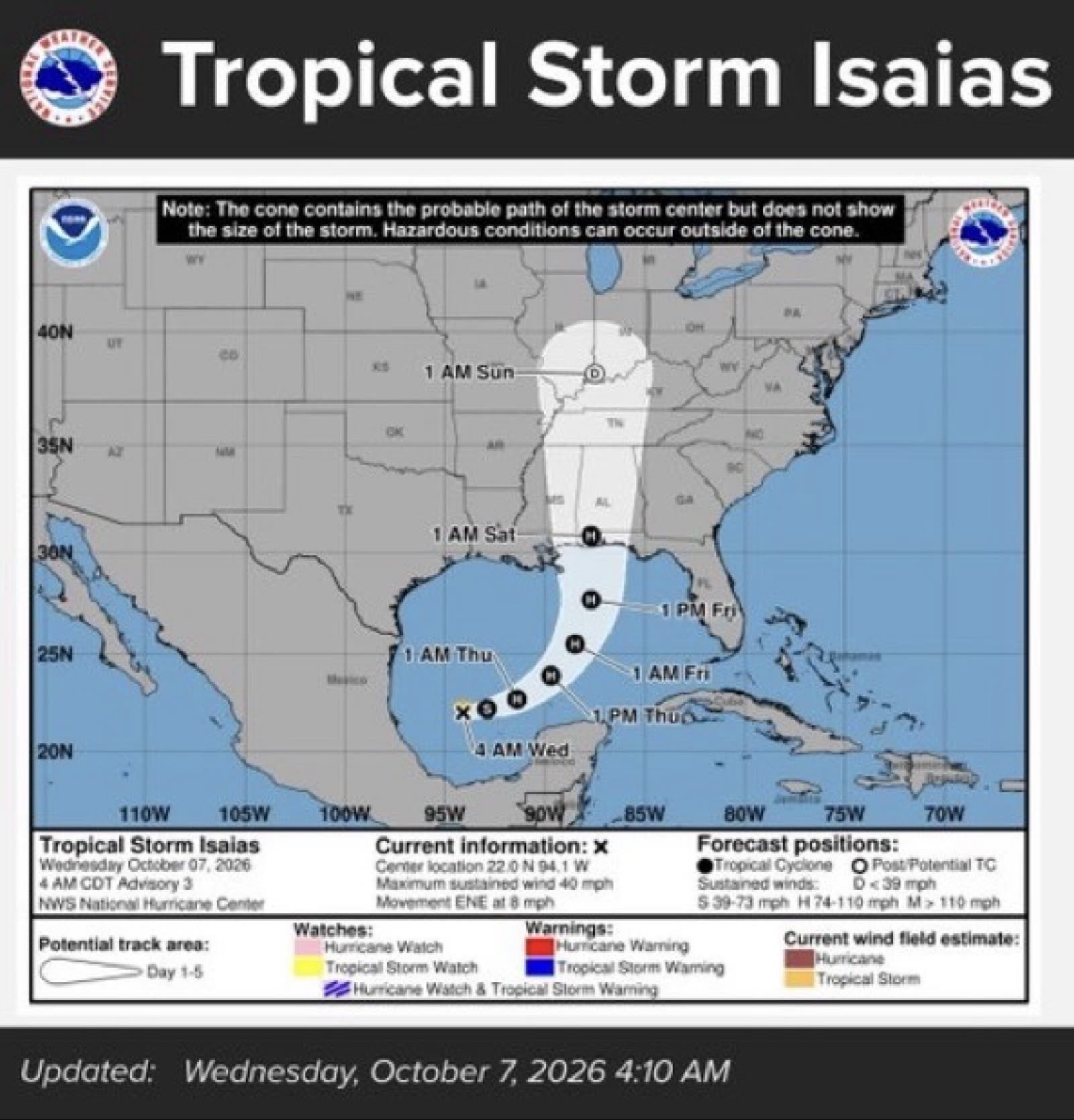
Tropical Storm Isaias expected to strengthen into first hurricane of 2026 season; our coverage area could see rain, wind and flooding
 LIVE NOW
- Tropical Storm Isaias strengthening in Gulf of Mexico; expected to become hurricane before Friday landfall on northern Gulf Coast.
- East Alabama and West Georgia will experience heavy rain, gusty winds, and flooding Friday night through Saturday from Isaias.
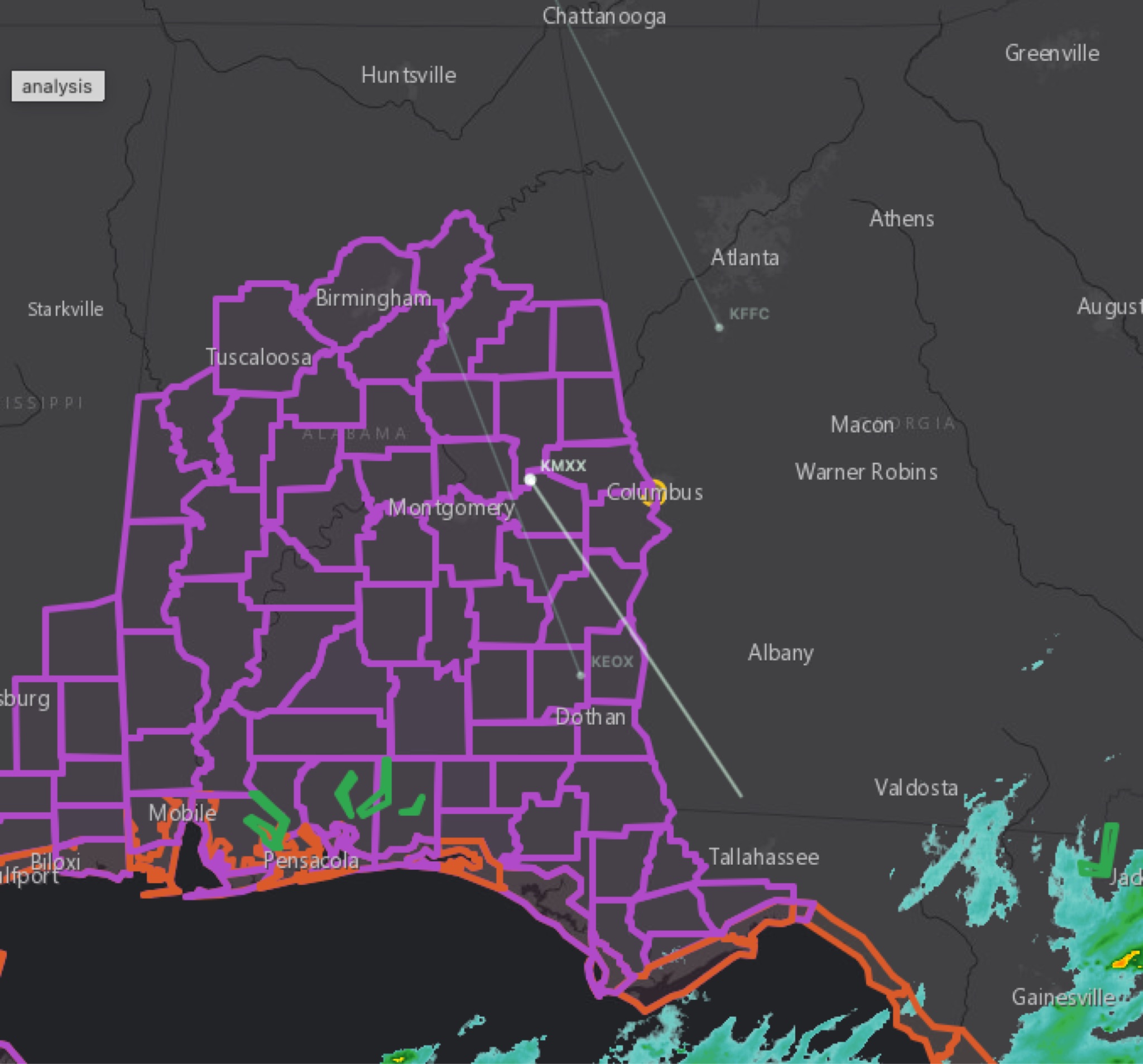
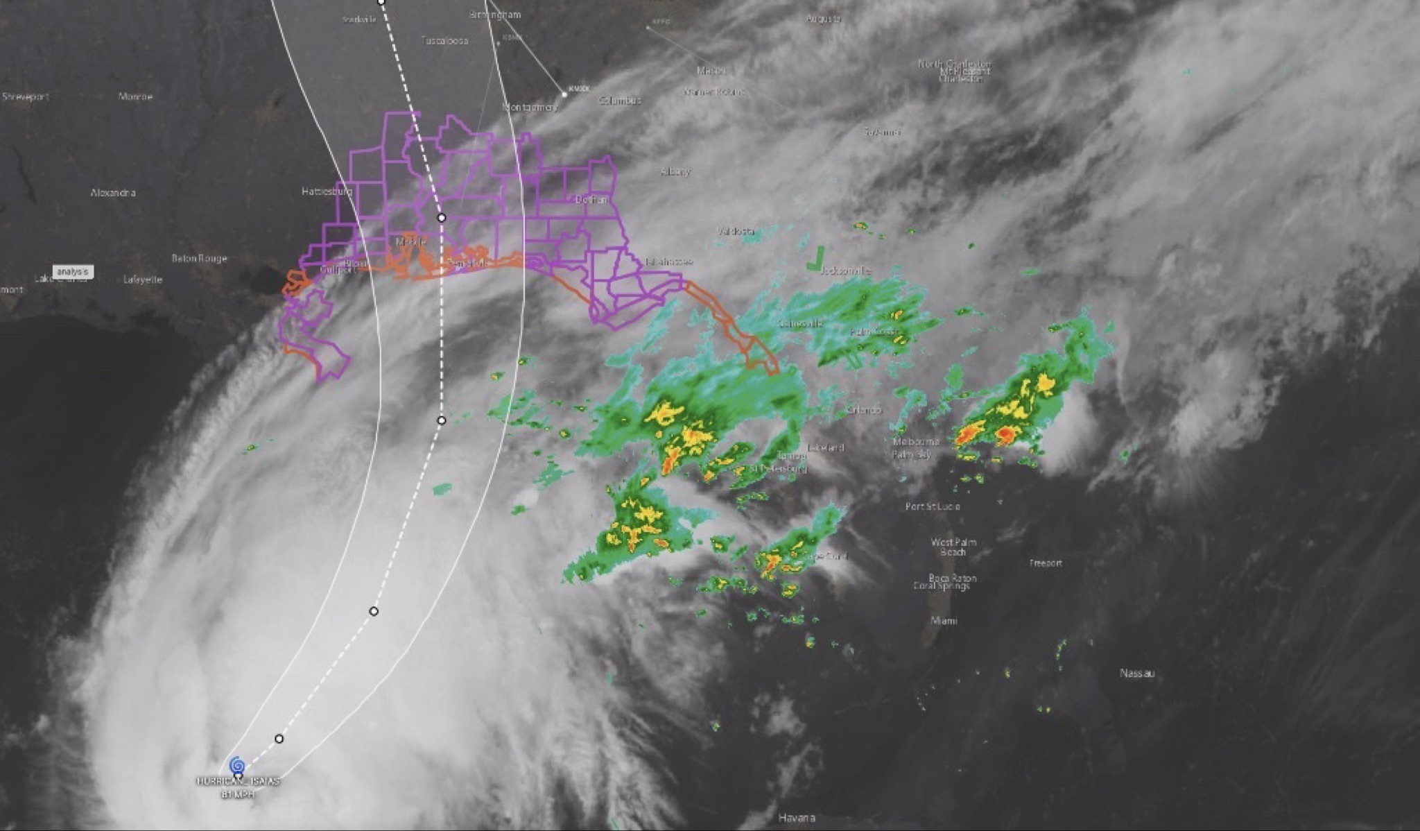
Tropical Storm Isaias continues to strengthen in the Gulf of Mexico, and the threat of significant impacts along the northern Gulf Coast is increasing, according to the latest update from the National Hurricane Center. Isaias is now expected to strengthen into a strong hurricane before reaching the northern Gulf Coast on Friday. A Storm Surge Watch has been issued from the mouth of the Mississippi River to Yankeetown, Florida, as forecasters warn of an increasing risk of life-threatening storm surge along portions of the northern Gulf Coast. A separate Hurricane Watch is now in effect from Bay St. Louis, Mississippi, to Indian Pass, Florida. Residents in the watch area are being urged to prepare for the possibility of long-duration power outages. 🌧️ Impacts for East Alabama and West Georgia For CNAW2News' coverage area, the biggest concerns remain heavy rainfall, gusty winds and flooding. Isaias is expected to bring heavy rainfall to the central U.S. Gulf Coast and much of the Southeast beginning Friday and continuing through the weekend. For East Alabama and West Georgia, including the Auburn area, rain is expected to increase Friday night and continue through Saturday, with periods of heavier rain possible. Flash flooding, urban flooding and isolated river flooding will be possible. Gusty winds are also expected, with the exact strength depending on the storm's eventual track and intensity. 🌀 The forecast is becoming more concerning The latest forecast shows Isaias moving northward toward the Gulf Coast, with the storm potentially making landfall somewhere along the central Gulf Coast on Friday. However, the exact landfall location and intensity remain uncertain, and changes to the forecast are still expected. Residents should not focus solely on the center of the forecast cone. Dangerous conditions can occur well outside the cone, particularly with rainfall, flooding, winds and storm surge. CNAW2News will continue closely monitoring Isaias for East Alabama and West Georgia, including Auburn, Opelika, Phenix City, Columbus and surrounding communities. Residents should continue monitoring official forecasts and begin making preparations now, especially for power outages, flooding and strong winds. Stay weather aware. Stay prepared.
Tropical Storm Isaias has formed in the Gulf of Mexico and is expected to strengthen into a hurricane within the next 24 hours, potentially becoming the first hurricane of the 2026 Atlantic hurricane season.
According to the latest forecast information, Isaias is expected to continue strengthening as it moves toward the northern Gulf Coast. The storm could make landfall somewhere along the central Gulf Coast from Louisiana to the Florida Panhandle late Friday into Saturday morning, although the exact location remains uncertain.
For East Alabama coverage area, the primary impacts are expected to come from rain, gusty winds and the potential for flooding.
Rain is expected to begin developing across the area Friday night and continue through Saturday night, with bands of heavier rain possible at times.
Current rainfall projections remain uncertain, with forecast guidance showing a broad range of approximately 1 to 4 inches depending on the eventual track and strength of the storm.
Windy conditions are also expected at times, particularly across the East Alabama area from Friday into Saturday. The exact wind speeds will depend heavily on how strong Isaias becomes and how close the storm tracks to Alabama.
The latest National Weather Service messaging also emphasizes that model uncertainty remains regarding the timing, intensity and exact track of Isaias, meaning the forecast will likely continue to change over the next couple of days.
For residents across East Alabama and West Georgia, now is a good time to begin preparing for the possibility of prolonged rain, gusty winds and localized flooding. Residents should continue monitoring official forecasts, especially if they live in areas prone to flooding or have outdoor items that could become hazardous in strong winds.
This storm is expected to evolve quickly, and the forecast will become more certain as Isaias approaches the Gulf Coast.
CNAW2News.com will continue monitoring Tropical Storm Isaias and provide updates as new information becomes available.
Related stories
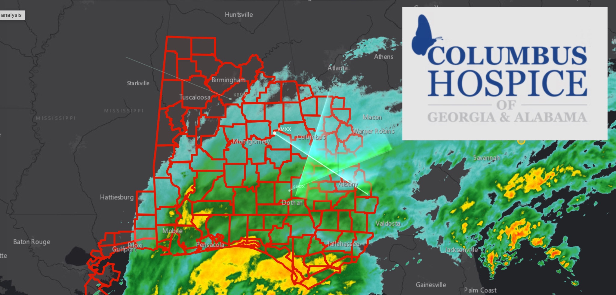 WeatherBREAKING: TROPICAL STORM WARNING EXPANDS ACROSS EAST ALABAMA AND WEST GEORGIA AS HURRICANE ISAIAS APPROACHES
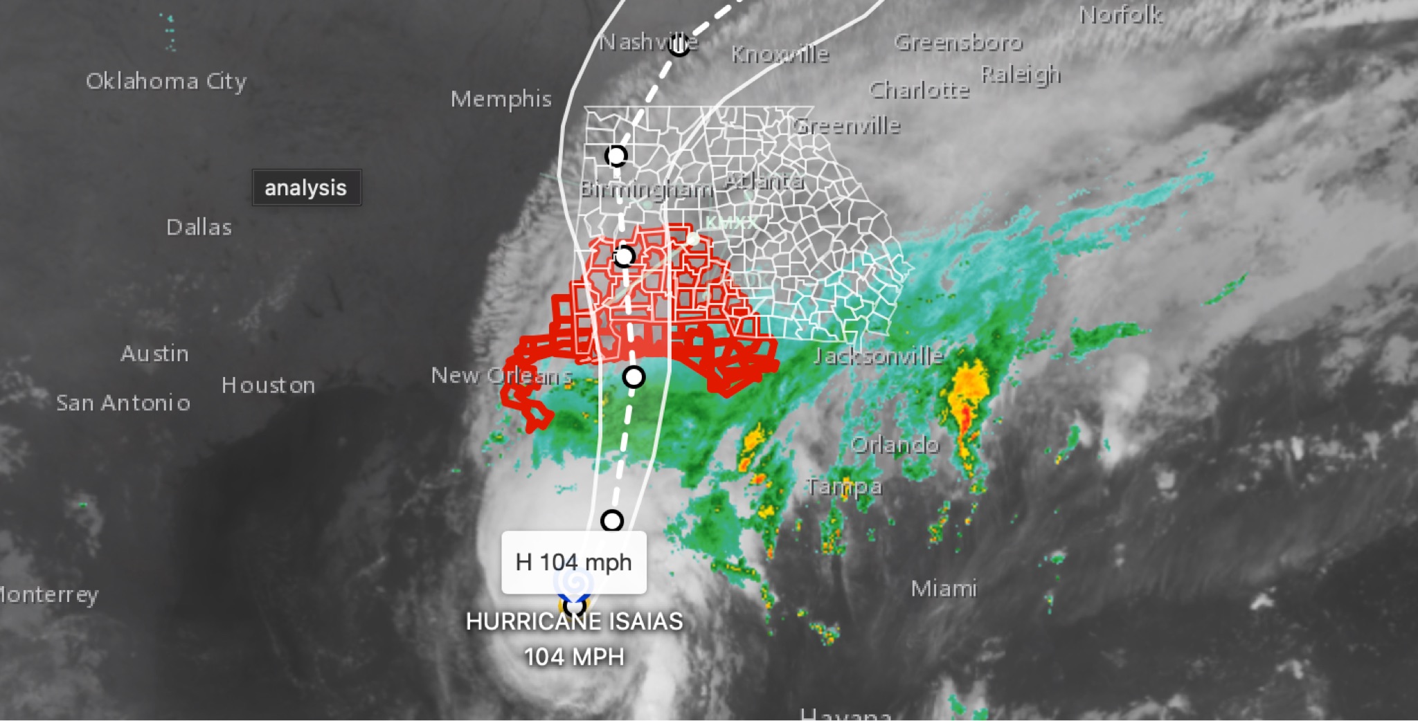 WeatherBREAKING: Hurricane Isaias strengthens to 104MPH in 11 p.m. advisory; East Alabama and West Georgia face flooding, wind, tornado threats
 WeatherBREAKING: Tropical Storm Watch Issued for East Alabama as Hurricane Isaias approaches
 WeatherBREAKING: Two alabamians dead following Hurricane Isaias as storm recovery efforts continue
 WeatherHURRICANE ISAIAS: East Alabama and West Georgia brace for heavy rain, strong winds and tornado threat